LiDAR 3D Scanner: How Laser Mapping Technology Captures Real-World Environments
Capturing accurate three-dimensional information about the physical world has become increasingly important in construction, surveying, architecture, robotics, engineering, and industrial development. A LiDAR 3D scanner makes this possible by measuring distances using laser light and converting the collected information into digital representations of real-world environments.
Unlike traditional measuring instruments that capture individual dimensions, LiDAR systems can collect millions of spatial measurements to create detailed three-dimensional point clouds. These digital datasets can be used for mapping, spatial analysis, infrastructure documentation, and environmental modeling.
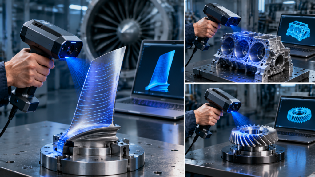
However, LiDAR is not the only technology used for 3D scanning. Structured-light and blue-laser scanners serve different purposes, particularly when capturing detailed product geometry and smaller mechanical components.
Understanding these technologies will help you choose the right scanning solution for your project.
What Is a LiDAR 3D Scanner?
LiDAR stands for Light Detection and Ranging. A LiDAR 3D scanner uses laser light to measure distances between the scanning device and surrounding surfaces.
The system emits laser pulses and measures the time required for reflected light to return to its sensor. Using this information, it calculates distances and determines the spatial positions of captured points.
Some systems use phase-shift measurement rather than direct pulse timing.
By collecting large numbers of measurements from different directions, the scanner creates a three-dimensional point cloud representing the surrounding environment.
Depending on the equipment, this information can be processed into:
- 3D point clouds.
- Digital terrain models.
- Building and architectural models.
- Infrastructure representations.
- Environmental maps.
- Three-dimensional spatial datasets.
LiDAR is particularly useful when capturing large spaces or environments where conventional close-range object scanning would be impractical.
How Does LiDAR 3D Scanning Work?
A typical LiDAR scanning workflow involves four main stages.
1. Laser Emission
The scanner emits laser light toward surrounding objects or surfaces.
2. Distance Measurement
The sensor detects reflected laser signals and calculates the distance using the system’s measurement method.
3. Spatial Position Calculation
The system combines distance information with its orientation and position to determine the three-dimensional coordinates of captured points.
4. Point Cloud Generation
The collected measurements are combined into a point cloud that represents the scanned environment.
Additional software can process this information into usable 3D models, maps, and spatial datasets.
For mobile and aerial LiDAR systems, positioning and orientation information from GNSS, inertial measurement units, or SLAM technology can also support spatial reconstruction.
Different Types of LiDAR 3D Scanners
LiDAR technology is available in several configurations, each designed for different environments and applications.
1. Terrestrial LiDAR Scanners
Terrestrial LiDAR scanners are generally mounted on tripods and used to capture buildings, construction sites, industrial facilities, and other stationary environments.
They can collect large quantities of spatial information without requiring physical contact with the scanned surfaces.
Common applications include architectural documentation, construction measurement, infrastructure inspection, and industrial facility mapping.
2. Mobile LiDAR Scanners
Mobile LiDAR systems capture spatial information while moving through an environment.
They may be mounted on vehicles, carried by operators, or integrated into mobile mapping platforms.
These systems are useful for road surveying, indoor mapping, warehouse documentation, and large-scale infrastructure projects.
SLAM technology can help estimate movement and maintain spatial alignment when GNSS positioning is unavailable or unreliable.
3. Aerial LiDAR Scanners
Aerial LiDAR systems are commonly mounted on drones, aircraft, or other airborne platforms.
They capture extensive geographic areas and generate spatial datasets for applications such as:
- Topographic surveying.
- Forestry analysis.
- Land development.
- Flood modeling.
- Infrastructure planning.
- Environmental research.
Their ability to collect elevation and surface information across large areas makes them valuable for geographic and engineering projects.
4. Solid-State LiDAR Scanners
Solid-state LiDAR systems use electronic or semiconductor-based approaches to direct or receive laser measurements without relying on conventional mechanically rotating scanning assemblies.
They are used in applications such as robotics, automotive perception, and compact spatial sensing.
Their capabilities vary considerably depending on sensor architecture, measurement range, field of view, and intended environment.
What Are LiDAR 3D Scanners Used For?
LiDAR technology supports a wide range of professional applications.
Construction and Architecture
Construction professionals use LiDAR to document buildings, capture existing site conditions, and compare physical structures against digital project information.
Scanned point clouds can provide useful references for renovation, structural documentation, and building information modeling workflows.
Land Surveying and Mapping
Surveying professionals use LiDAR to capture elevation information and create detailed representations of terrain.
These datasets can support land development, infrastructure planning, and geographic analysis.
Automotive and Autonomous Systems
Automotive manufacturers and robotics developers use LiDAR sensors to measure surrounding distances and identify objects within an environment.
This spatial information can support perception, navigation, and obstacle detection systems.
Industrial Facility Documentation
LiDAR can capture large industrial spaces, including factories, warehouses, and production facilities.
The resulting point clouds can help document existing installations and support facility planning.
Environmental Applications
Researchers use LiDAR to study terrain, vegetation structure, forest environments, and other landscape characteristics.
It provides spatial information that can complement conventional surveying and remote-sensing methods.
LiDAR vs. Structured Light vs. Blue Laser Scanning
Although these technologies all capture three-dimensional information, their measurement approaches and typical applications differ.
| Feature | LiDAR | Structured Light | Blue Laser Scanning |
|---|---|---|---|
| Measurement principle | Laser distance measurement | Projected light patterns | Laser-line measurement |
| Typical application | Large environments | Detailed object capture | Engineering components |
| Common targets | Buildings and landscapes | Products and objects | Mechanical parts |
| Main advantage | Large-area spatial coverage | Detailed surface geometry | Detailed geometric capture |
| Typical output | Spatial point clouds | Point clouds and meshes | Point clouds and meshes |
LiDAR is often more appropriate for mapping large environments, while structured-light and blue-laser systems are commonly used for detailed object scanning.
The best technology depends on the required measurement range, geometric detail, surface characteristics, and intended application.
What Should You Consider When Buying a LiDAR 3D Scanner?
Selecting a suitable LiDAR system requires evaluating several technical specifications.
Measurement Range: Determine the maximum and minimum distances at which the system can reliably capture surfaces.
Accuracy: Check the manufacturer’s stated measurement accuracy and the conditions under which it was evaluated.
Point Density: Higher point density can provide more detailed spatial information, depending on scanning distance and configuration.
Field of View: A wider field of view can help capture larger areas with fewer scanning positions.
Outdoor Performance: Consider ambient lighting, weather resistance, and performance under different environmental conditions.
Software Compatibility: Check whether the system supports point-cloud processing, registration, mapping, and the file formats used in your workflow.
Portability: Consider whether a tripod-mounted, handheld, vehicle-mounted, or aerial system is most suitable for your application.
Is LiDAR the Right Choice for Detailed 3D Object Scanning?
Not necessarily.
LiDAR is excellent for many large-scale spatial measurement applications, but it is not automatically the best option for capturing small objects with intricate surface details.
For example, an engineer reconstructing a small mechanical component may benefit more from a close-range blue-laser or structured-light scanner.
Similarly, a product designer capturing a miniature model may need a scanner optimized for fine surface detail rather than long-distance measurement.
This distinction is important when choosing professional scanning equipment.
Revopoint offers optical 3D scanning technologies, including blue laser, structured-light, infrared, and optical tracking systems. These are designed for different object-scanning and engineering applications rather than being represented as LiDAR systems.
Find the Right 3D Scanning Technology for Your Project
LiDAR 3D scanning provides valuable capabilities for mapping, surveying, construction, infrastructure documentation, and large-scale spatial measurement.
However, projects involving detailed mechanical components, product development, reverse engineering, and 3D printing may require different scanning technologies.
Before purchasing, identify the size of your scanning targets, required measurement accuracy, environmental conditions, and intended digital workflow.
Explore the lidar 3d scanner collection to compare Revopoint’s available optical scanning solutions and identify equipment suited to detailed object capture, engineering, reverse engineering, and 3D printing applications.